

Tracking the North Country's Christmas Weekend Storm
/
Tony Tenda, Schroon's trusted local authority on all things weather, has filed his latest report via his Facebook weather page:
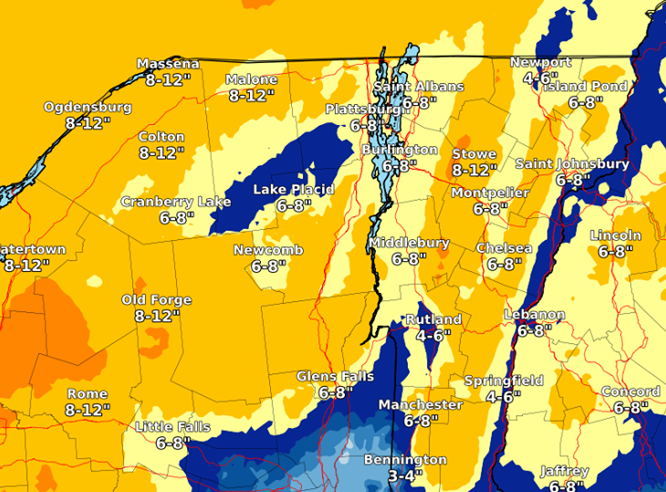
Tony's Schroon Lake Weather Page shared US National Weather Service Burlington VT's post.
A quick look at the week ahead. Storm for Friday through Saturday, snow Friday into Saturday morning, 5" - 8". Because of the track of the storm, some warm air will be worked into the storm, turning the snow to sleet, freezing rain, and possibly plain rain.
This storm looked to be very rainy a few days ago, but it has consistently trended colder each model run, so rain looks to be minimal. Everything turns back to a little snow as the storm passes us, ushering in colder air. Sunday, Christmas Eve looks quiet, but Christmas day a weak storm looks to drop 1" - 4" snow. This storm was looking a lot bigger just a couple days ago. As this storm passes, cold Arctic air will flood the Northeast, and the lake effect snow machine will be cranking Tues and beyond. Next week will be very cold. Signs of a bigger storm for next weekend.